
Many ways in. One place worth reaching.
Whether you want a short walk in from the closest access road or a multi-day Appalachian Trail approach, The Cut can be reached from several key A.T. parking points.
Hike in from Georgia
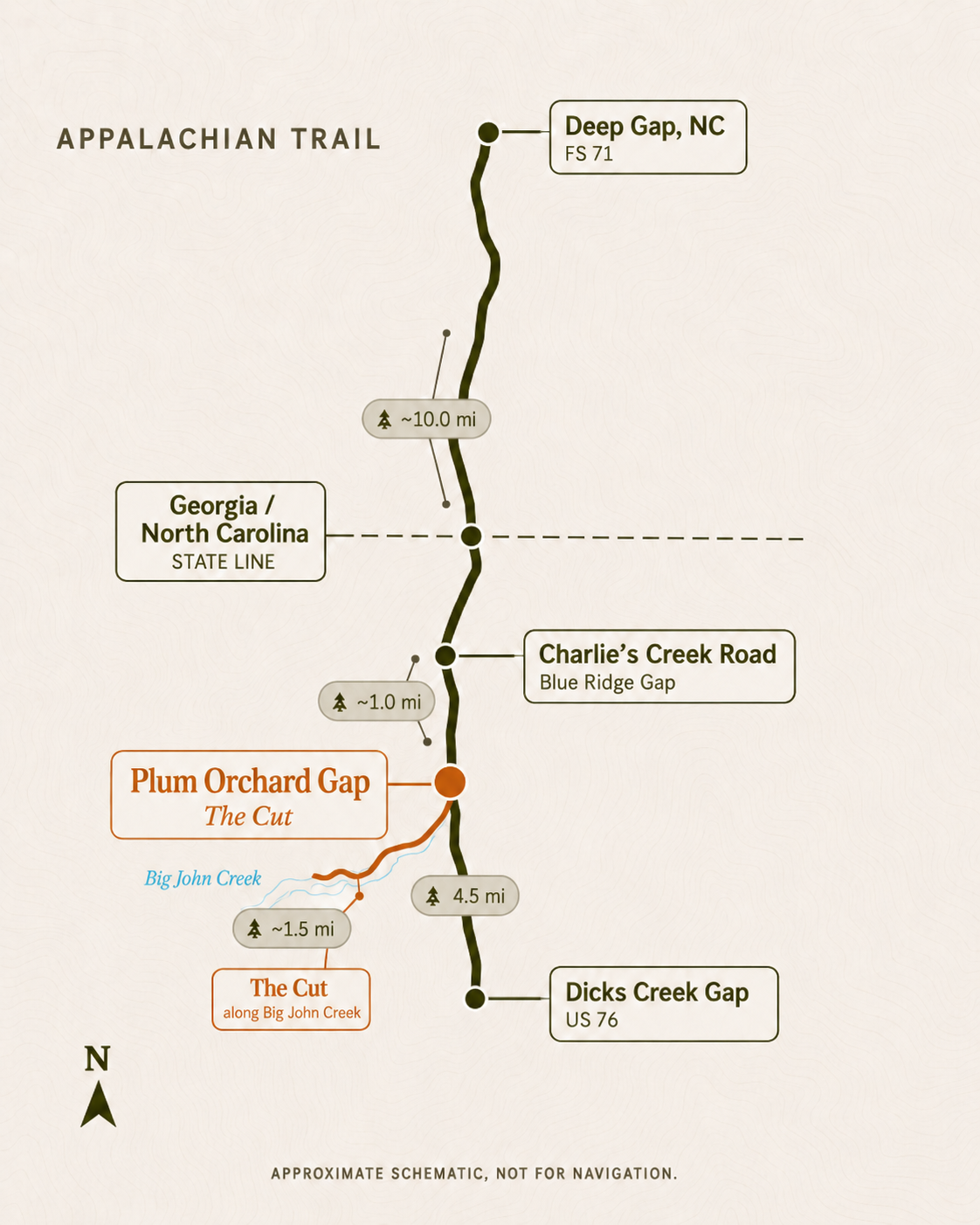
Charlie’s Creek Road (Shortest hike)
This is the shortest hike in, but the road is rough and better suited for drop-offs, shuttles, or capable high-clearance vehicles.
Approx. 1.3 miles | 1 to 2 hours
Dicks Creek Gap (Closest paved parking area) The best practical A.T. parking option near Hiawassee. This paved-road trailhead on US 76 gives hikers a true A.T. approach without committing to a multi-day section.
Approx. 4.5 miles | 2 to 4.5 hours
Unicoi Gap
A longer overnight approach from GA 75, crossing a rugged and beautiful stretch of the Georgia A.T. before reaching the Plumorchard area.
Approx. 21.2 miles | 1 long day to 3 days
Byron Herbert Reece / Neel Gap
A classic North Georgia A.T. starting point near Blood Mountain and Mountain Crossings. This is a real section hike, suited for guests who want to earn the arrival over several days.
Approx. 44 miles | 3 to 5 days
Woody Gap
A strong longer section-hike start from GA 60 with established parking and access to some of the best-known terrain on the Georgia A.T.
Approx. 53.7 miles | 4 to 7 days
Three Forks
A remote Forest Service road access point near Long Creek Falls, best for hikers starting deep in the southern Georgia section.
Approx. 69.9 miles | 5 to 9 days
Springer Mountain Parking Area
For hikers who want the full Georgia approach, start near the southern terminus and hike north through almost the entire Georgia A.T. before reaching Plumorchard Gap.
Approx. 73.2 miles | 5 to 10 days
Hike in from North Carolina
Deep Gap, NC
The closest northern A.T. access point, best for shuttles or capable vehicles.
Approx. 11.3 miles | 5 to 9 hours or 1 overnight
Winding Stair Gap
A strong paved-road starting point near Franklin for hikers who want a real southbound section hike.
Approx. 35.7 miles | 2 to 5 days
Wayah Gap / Wayah Bald
A scenic, higher-elevation start for hikers who want a longer approach through classic North Carolina A.T. country.
Approx. 42 to 46 miles | 3 to 6 days
Nantahala Outdoor Center
An iconic A.T. starting point for a bigger southbound section hike into Georgia.
Approx. 63 to 64 miles | 5 to 8 days
Shuttle Service & Drop Offs
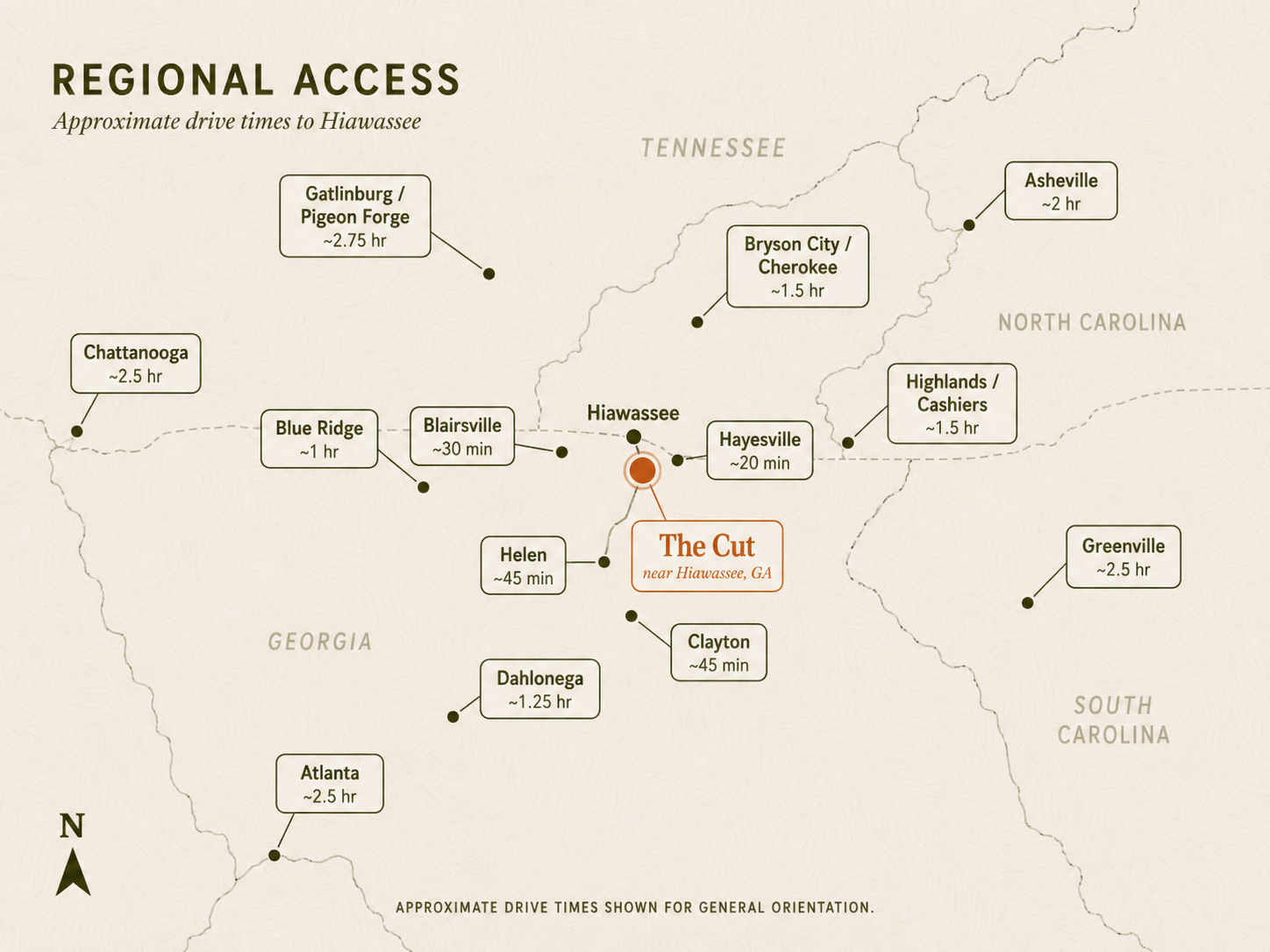
In addition to the trailheads, there are several nearby parking options in Hiawassee from which local shuttle services can pick you up, take you to the trailhead for your hike, and return you to your car at the end of your stay.
Limited drop-off access may be available by prior arrangement, but The Cut is designed around a quiet, low-traffic experience, so vehicle access is limited and scheduled.
Waitlist members get first access when opening dates are released, along with opening-season savings and limited Cut gear.